School nearby Ibnou Sina
Tunisia
School nearby Ibnou Sina
Ibnou Sina
Mégrine, Tunisia
contacts phone
:
+216
Latitude:
36.7703105
, Longitude:
10.2360054
larger map & directions
read more
nearest School
151 m
Institution Éducative Privée Rania
3 rue Bechir Sfar Megrine, Mégrine
School
read more
177 m
Amg English Academy
Mégrine
School
read more
230 m
Institute Molière Des Langues Mégrine
23, Avenue Habib Bourguiba, Megrine
School
read more
307 m
Garden Baby - Rahat Mama
Maqrin
School
read more
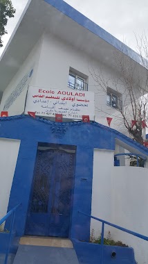
375 m
School And College Private Awledi
Mégrine
School
read more
400 m
Club D'Enfants Megrine Coteau
coteau, Mégrine
School
read more
614 m
Institute Health Mohamed
Rue de la Gare, Megrine
School
read more
655 m
Lycée Al Amal
Mégrine
School
read more
687 m
Private Middle School Awledi
Mégrine
School
read more
740 m
93 Avenue Habib Bourguiba Megrine 2033
Unnamed Road, Megrine
School
read more
754 m
المركز القطاعي للتكوين في تقنيات الجلد والأحذية بمقرين
Megrine Riadh
School
read more
810 m
Higher Institute De La Magistrature
Rue de la Gare, Megrine
School
read more
830 m
College Pilote De Megrine
Mégrine
School
read more
919 m
MCM Fomation Future
SOMEF TUNISIE, Megrine Riadh
School
read more
985 m
Jardin D'enfants Hela Baalouche
12 RUE DE PALMIERS SIDI REZIG 2033, Megrine
School
read more
987 m
Nursery School Angel's
Mégrine
School
read more
1.135 km
Iieop
Mégrine
School
read more
1.193 km
معهد طه حسين مقرين جوهرة
Megrine
School
read more
1.23 km
Mcm Formation
Unnamed Road, Mégrine
School
read more
1.25 km
Primary School Mégrine Riadh
Megrine Riadh
School
read more
2.328 km
Primary School Charles Nicolle
Ben Arous
School
read more
2.652 km
Middle School Aboul Kacem Ecchabi
Rue sidi Khlil, Ben Arous
School
read more
2.951 km
Lycée Ibn Mandhour المعهد الثانوي ابن منظور
2063, Ben Arous
School
read more
3.18 km
École Maternelle La Sûrté
2063,, Ben Arous
School
read more
3.211 km
معهد الخيام للفنون
Ben Arous
School
read more
📑
all categories
Accounting
Administrative area level 1
Administrative area level 2
Airport
Amusement park
Aquarium
Art gallery
Atm
Bakery
Bank
Bar
Beauty salon
Bicycle store
Book store
Bowling alley
Bus station
Cafe
Campground
Car dealer
Car rental
Car repair
Car wash
Casino
Cemetery
Church
City hall
Clothing store
Convenience store
Courthouse
Dentist
Department store
Doctor
Electrician
Electronics store
Embassy
Establishment
Finance
Fire station
Florist
Food
Furniture store
Gas station
General contractor
Grocery or supermarket
Gym
Hair care
Hardware store
Health
Home goods store
Hospital
Insurance agency
Jewelry store
Laundry
Lawyer
Library
Liquor store
Local government office
Locality
Locksmith
Lodging
Meal delivery
Meal takeaway
Mosque
Movie rental
Movie theater
Moving company
Museum
Natural feature
Neighborhood
Night club
Painter
Park
Parking
Pet store
Pharmacy
Physiotherapist
Place of worship
Plumber
Point of interest
Police
Post office
Premise
Real estate agency
Restaurant
Roofing contractor
Route
School
Shoe store
Shopping mall
Spa
Stadium
Storage
Store
Subway station
Supermarket
Synagogue
Taxi stand
Train station
Transit station
Travel agency
University
Veterinary care
Zoo
sublocality level 1
↑